LIFE ALONG THE RIO LA PASION
Story & Photos by Vicki Andersen
Lulled into a hypnotic trance by the rhythmic advance of our boat as we journeyed
upstream, the serenity was broken only by occasional flurries of flapping wings
as some avian creature took umbrage at our passage. Suddenly a loud SPLASH caught
our attention when a Crocodylus moreletti slid his massive reptilian body into
the murky water, tail thrashing in frustration. Eyes gleaming in the sun, he
glowered at our intrusion into his morning sunbathing ritual. This river, which
translates into English as the River of Passion, certainly arouses a multitude
of passions and emotions in me each time I travel its corridors.
 |
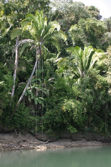
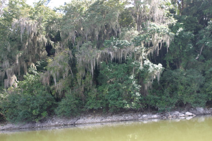
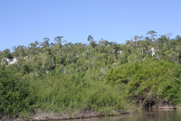
Located in the western lowlands region of northern Guatemala, the River of Passion flows in a sinuous and westward advance. It's drainage system covers an area of nearly 2,000 square miles, home to a complex system of tributaries and swamps which fed the river. Eventually it joins the Salinas River, and their confluence forms the Usumacinta, third in size only to the Amazon and Mississippi in the Americas, and marking the border between Guatemala and Mexico. Branching off the Rio la Pasion at Sayaxche, Rio Petexbatun forms a small lake of the same name, five miles long by one-half mile wide and very shallow. The colors of these rivers run the gambit from silt-rich olive green to deep azure. |
|
RIO PETEXBATUN
|
 |
|
Heavy rainfall in this area nurtures a dense tropical forest. Feathery Castillian
cane cloak many portions of the riverbank. Mighty ceiba and massive mahogany
trees rise above the lush vegetation. Yellow flowers of the palo blanco and
orange blossoms of the amapola provide a riot of color against the a backdrop
of many-hued greens. Even Pucte Lagoon harbors a secret underwater garden where,
many feet below the surface, water lilies bloom as though they were breathing
humid jungle air rather than water.
 |
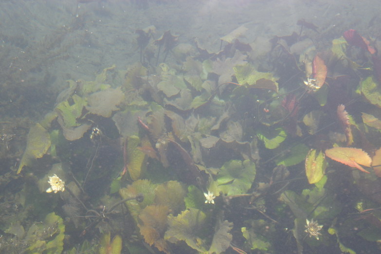 |
| PUCTE LAGOON'S UNDERWATER GARDEN |
 |
 |
|
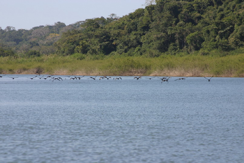
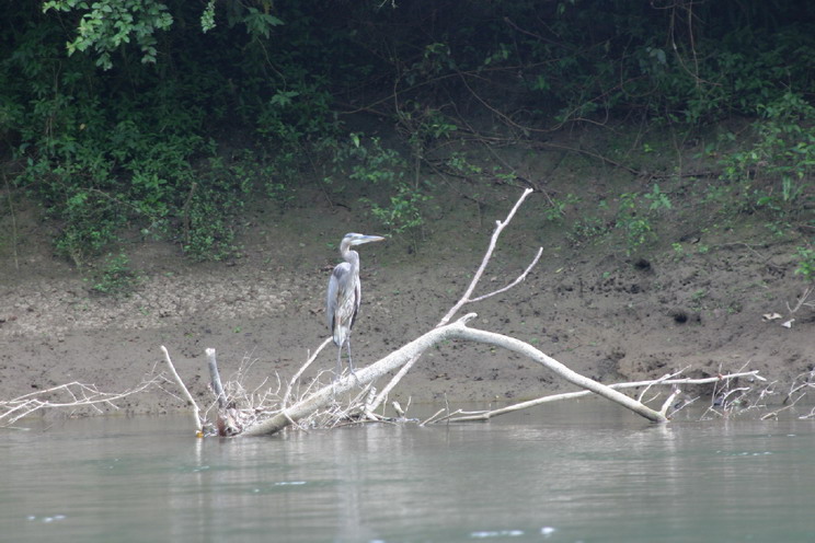
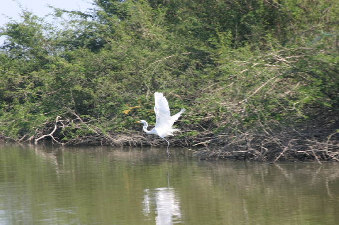
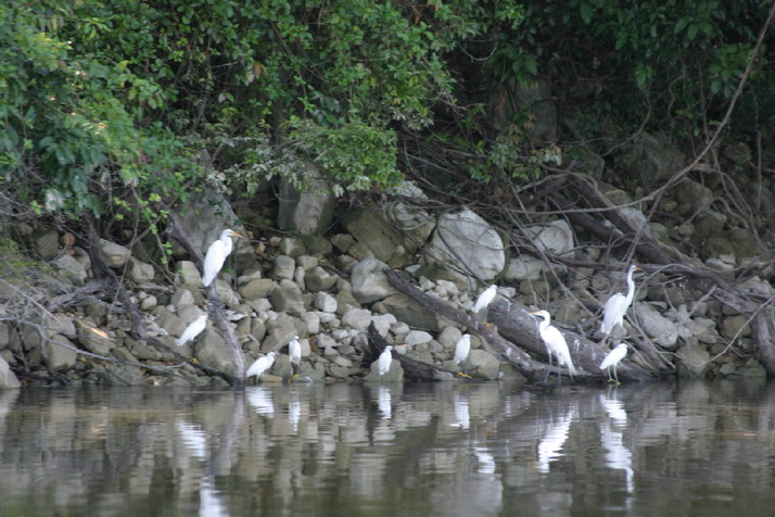
BLUE HERON
|
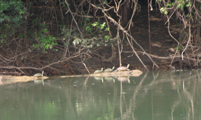
Among the countless denizens of this region are howler monkeys, turtles, a
variety of lizards and Morlet's crocodiles. The rivers teem with fish including
blanco, snook, rinco, bass and a seasonal influx of tarpon. During one of my
journeys, I shared a ride with a lady who was an avid birder. As I snapped off
image after image of birds in a wide variety of plumage, she gasped in astonishment
over species she'd never before seen, and clicked off the names as though I
could possibly remember them all. Later, with pen and paper in hand, I asked
if she would recall as many as she could: storks, snowy egrets, great egrets
a.k.a. great herons, little blue herons, green herons, black-crowned night herons,
belted kingfishers, green kingfishers, ringed kingfishers, pelicans, flamingos,
hawks, peregrine falcons, cormorants… And she thought she may have missed
a few. Birds, singularly or in massive flocks, take flight to pace alongside
the boat or hunt the jungle canopy and rich waters.
 |
 |
|
TURTLES
|
EGRETS
|
 |
 |
|
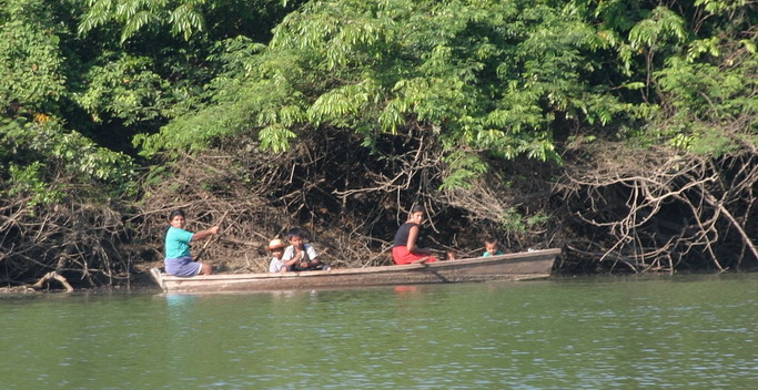
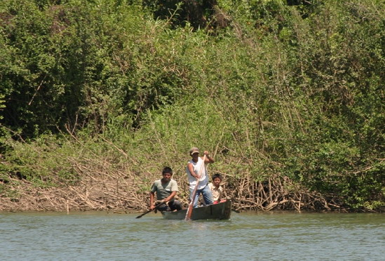
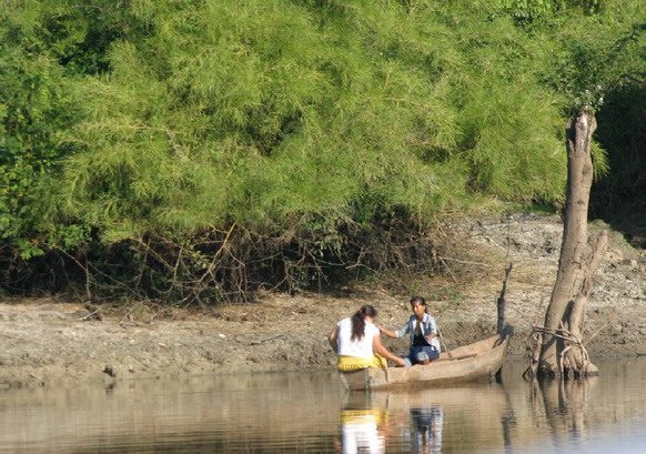
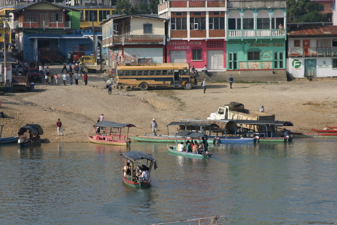
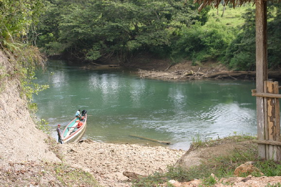
RIVER TAXI
|
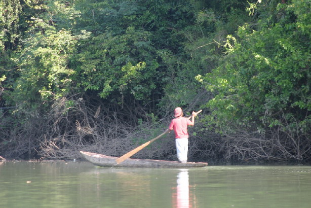
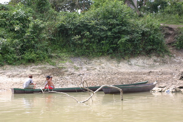
Boats ply the river, some carrying commerce, others transporting families or
the handful of visitors who pass this way. Locales use their watercraft as a
base for fishing or scanning the dense vegetation for food to harvest from the
vines and trees.
 |
 |
 |
 |
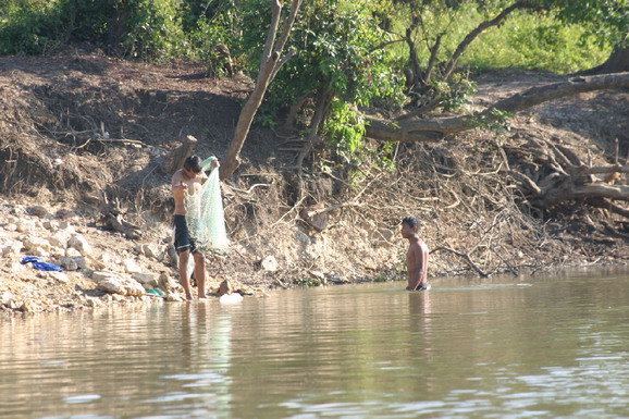
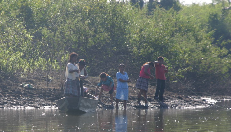
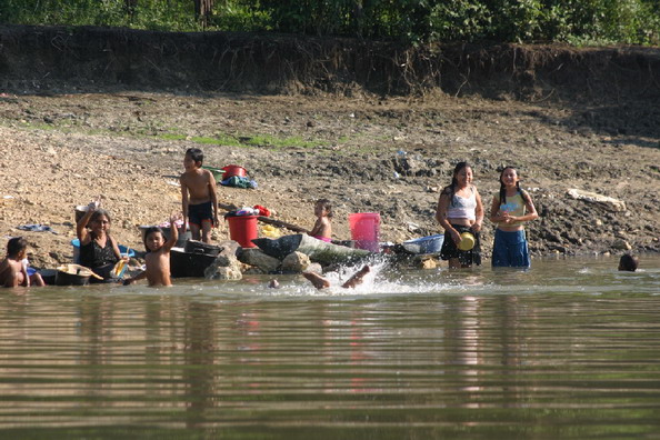
Along this watery path are vivid scenes of daily life. Men, women and children
stand patiently and watch for signs of dinner at the end of their fishing line
or captured in their net. Its waters wash dishes and bathe bodies. Idle dugout
canoes become a playground for children. Moored boats transform into diving
platforms as youngsters swim and splash about. Women congregate in groups to
do their laundry while sharing the news and gossip.
 |
 |
 |
|
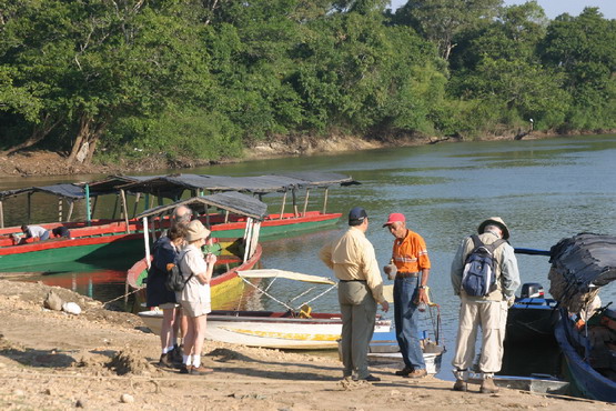
The few visitors who come here are greeted with shy smiles and friendly waves
from the inhabitants, who are mostly of Maya descent. Many of them migrated
here over the last four decades in search of land, or to escape the brutal 36-year-long
civil war that decimated their people, particularly in the Highlands region.
 |
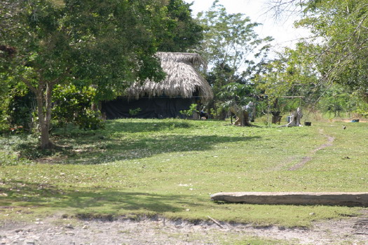 |
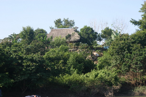
About two dozen small villages are scattered along the waterways, inland enough
that you'd never even realize they existed. A few well-camouflaged dwellings
peep through the jungle foliage here and there, or dot small clearings along
the shoreline where it's a constant struggle against the encroaching jungle.
The indigenous population either eke out a subsistence living or grow crops
such as maize, rice, cane, and sapodilla which produces a delicious fruit and
from whose bark chicle is extracted. As you proceed downriver and the dense
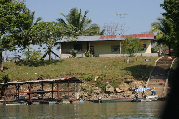
vegetation begins to taper out, a handful of co-op farms raise cattle who stand
guard above the banks and languidly watch you pass by. The affluence of these
farms is marked by homes and buildings built of concrete blocks and roofed with
metal.
 |
|
 |
 |
|
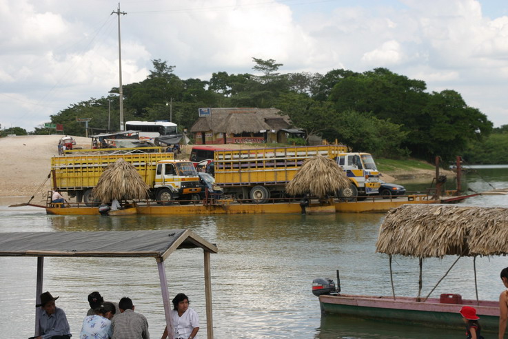
SAYAXCHE FERRY
|
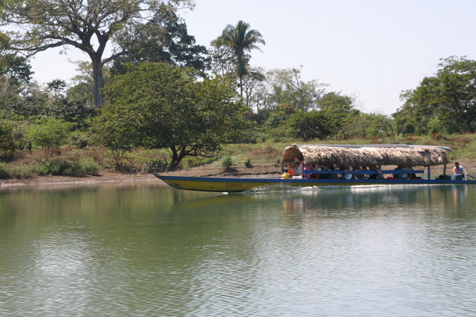
Sayaxche is the only major settlement along the river, if you can call an oversized village of 10,500 inhabitants "major". It offers a couple of small lodgings, an eatery or two, a very busy ferry shuttling vehicles and trucks from one bank to the other, a handful of outfitters with whom you can arrange a ride up or down river, and - wonder of wonders in the midst of the jungle - a tiny (and very slow speed) Internet café. Sayaxche is also the only real access onto the river, other than wending your way through the jungle.
 |
 |
|
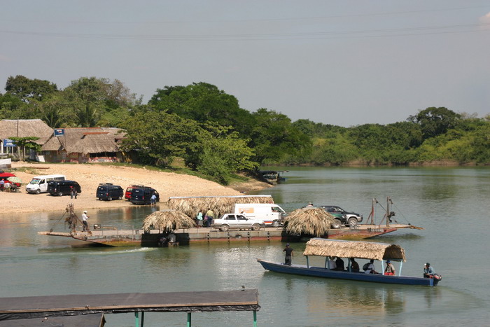
TRAVELERS ARRANGE TO DEPART SAYAXCHE
|
 |
 |
|
CANCUEN'S EASY RIVER ACCESS
|
AGUATECA'S BUILDINGS SIT ATOP A LIMESTONE ESCARPMENT
|
This waterway was a major trade route for the ancient Maya, who established important and powerful cities throughout the river basin. Luxury items from the resource-rich highlands such as jade, quetzal feathers, seashells and obsidian, as well as necessities like salt and ceramics made their way downriver, along with allspice, cacao, vanilla beans and other fare from the lowlands. Here, rather than constructing massive temple pyramids, the Maya built their cities atop the huge limestone plateaus.
Along this ancient superhighway flourished Cancuen, an important commercial center near the headwaters of the Rio la Pasion, and Ceibal, a major ceremonial center. Altar de Sacrificios owed its prominence to its location at the confluence of the Rio la Pasion and Salinas River, making it a vital trade center. Petexbatun was home to Aquateca and her nearby sister city of Dos Pilas, who reigned as twin capitals of the region during the late 600s and early 700s, and Tamarindito. Geographically, Punta de Chimino was a peninsula jutting into Lake Petexbatun, but after the Maya removed some 50,000 cubic yards of bedrock to create a series of three moats, it became a heavily-fortified man-made island.
 |
|
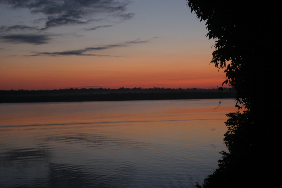
Dawn paints the sky over Laguna Petexbatun, and another incredible day of discovery awaits the intrepid traveller.
Vicki Andersen may be reached at: skicat1@comcast.net.
![]()
![]()
![]()
![]()
![]()